


WE'RE GOING ON A RIDE
HOW DO I START PLANNING A ROUTE?
In the beginning, planning a route can be one of the intimidating parts of starting to cycle more frequently.
The guide below is built exclusively using Google Maps and its native tools. If you are looking for more cycling-specific tools, we suggest Strava, Garmin Connect, and Ride with GPS. Just keep in mind that their full services require payment.
Ride with GPS has the most robust free version, but all three have paid versions with full and wide route planning services.


HOW TO PLAN A ROUTE
1. PICK A STARTING AND ENDING POINT FOR YOUR RIDE
Simple enough, figure out where you will be starting from and where your destination is.

2. NAVIGATE TO "GOOGLE MAPS" AND SELECT THE "BIKING" LAYER
On mobile, it will be in the upper right corner, on desktop, it will be on the lower left side.

3. TYPE THOSE TWO LOCATIONS INTO GOOGLE MAPS DIRECTIONS
Type your starting point and destination, and type them into Google Maps.
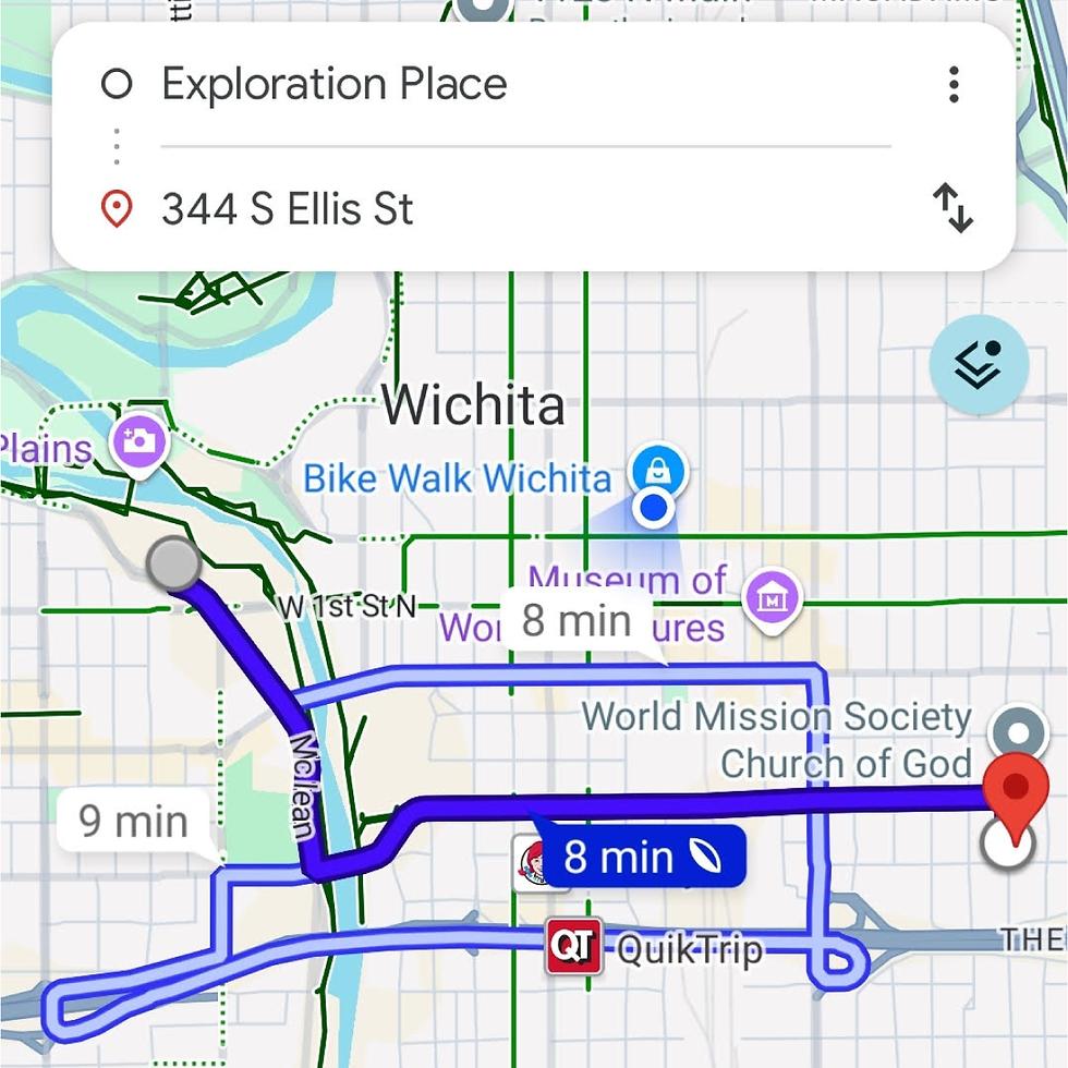
4. SWITCH THE MODE OF TRANSPORTATION TO "BIKE" IN GOOGLE MAPS
On desktop it will be located above the addresses, on mobile, it will be located in the lower part of the screen.

5. CHECK TO SEE IF THERE ARE ANY OTHER CLOSE BIKE PATHS OR ROUTES
Google Maps may take you down busier streets that you are not comfortable with. Check this Kansas Department of Transportation resource to see bike routes in Wichita.

5. TEST THE ROUTE, ADJUST, HAVE FUN, AND DON'T FORGET TO WEAR A HELMET!
Test your route by vehicle first if you can, adjust your route for your comfort, and when you're ready, go for it. Don't forget your helmet and any other gear you need.

SAMPLE ROUTES AROUND WICHITA
BIKE TO HAPPY HOUR - ROUTES TO CONSIDER
Below, we’ve put together some routes from randomly selected locations across Wichita. We used Garmin Connect’s Course Planning function to lay out some general routes. Then we modified those routes to prioritize low-stress, low-risk routes.
We aim to give some general directional routes that could be tapped and personalized for your particular location.
These routes are publicly available on Garmin Connect if you have a Garmin device you want to send them to.
Go to courses –> Nearby Courses –> Filters. Filter course name “B2HH” to see the full list of offerings.


Southwest Wichita to CSB
Starting at Glenn Park Christian Church
-
Head East on W 27th St S toward S Osage Ave.
-
Turn left and head North on S Osage Ave toward W Pawnee St.
-
Turn right and head East on W Pawnee St to the intersection with McLean Blvd.
-
At the intersection, turn left, enter the Riverside Trail and head North towards W 1st St N.
-
Head East on W 1st St N towards N Hydraulic Ave.
-
Turn right and head South on N Hydraulic Ave toward E Douglas Ave.
-
After you have crossed E Douglas Ave., turn right on E English St.
-
CSB will be to your right.
Distance: 6.04 miles | Overall Ascent/Descent: 9 ft

West Wichita to CSB
Starting at Hadley Middle School
-
Head East on W 9th St N towards N McLean Blvd.
-
Cross McLean and enter the Riverside Trail.
-
Head South on the Riverside Trail to W 1st St N.
-
Head East on W 1st St N towards N Hydraulic Ave.
-
Turn right on Hydraulic towards Douglas Ave.
-
After you have crossed E Douglas Ave., turn right on E English St.
-
CSB will be to your right.
Distance: 5.28 miles | Overall Ascent/Descent: -17 ft

Northeast Wichita to CSB
Starting at Calvary United Methodist Church
-
Head West on E 26th St N towards N Longfellow St.
-
Turn left and head South on N Longfellow St. toward E 24th St N.
-
Turn right and head West on E 24th St N, following the curve South onto N Rutland Rd.
-
Turn right, head Southwest on Bainbridge Rd. Following the road as it curves and terminates on N Bramblewood St.
-
Turn left and head Southwest on N Bramblewood St toward E 21st St N.
-
Cross E 21st St N and continue riding South along N Bramblewood St towards N Woodlawn Blvd.
-
Turn left and head South on N Woodland Blvd towards the Red Bud Trail.
-
Turn right and head West on the Red Bud Trail toward I-135.
-
Turn left and head South along the Canal Hike & Bike Trail underneath I-135 towards E English St.
-
Turn right and exit the Canal Path onto E English St. Head West on E English St toward Hyde Park.
-
CSB will be to your right.
Distance: 6.64 miles | Overall Ascent/Descent: -106 ft

Southeast Wichita to CSB
Starting at WSU Tech
-
Head South on S Roosevelt St towards Countryside St.
-
Turn right and head West on Countryside St toward George Washington Blvd.
-
Cross George Washington Blvd and proceed South towards E Funston St.
-
Turn right and head West on E Funston towards I-135.
-
As E Funston St approaches I-135, it will curve South. Use the pedestrian bridge near the curve to continue West over I-135.
-
Exit the pedestrian bridge, turn right, and head North along S Kansas Ave and continue under the E Harry St. bridge.
-
Once past the E Harry St Bridge, enter the Canal Hike & Bike Trail by turning right, heading East.
-
Follow the Canal Hike & Bike Trail North along I-135 past Kellogg toward E English St.
-
Turn left and exit the Canal Hike & Bike Trail onto E English St.
-
Head West on E English St toward Hyde Park.
-
CSB will be to your right.
Distance: 3.78 miles | Overall Ascent/Descent: -40 ft
OTHER FREQUENTLY ASKED QUESTIONS
During open shop hours we are happy to accept donations in any conditon!
Tuesday & Thursday | 2 - 8 p.m.
Friday & Saturday | 12 - 4 p.m.
Unfortunately, we do not have the resources to pick up or deliver bicycles.
We'd love to offer this service, and if you're interested in helping us do this, please let us know and we will work something out!
We do not do paid repairs.
We are focused on education and will not do repairs for you, but rather with you.
We will help you repair your bike.
Tuesday & Thursday | 2 - 8 p.m.
Friday & Saturday | 12 - 4 p.m.
Absolutely! We love helping people stay moving.
But there's a catch: We don't do the work for you, we do the work with you.
We'll show you how to do it, and then you will have all the time and support to accomplish your repair and will leave knowing how to do it next time.Usage of the stands and tools is free of charge, but it does take money to operate our program and support our community.
Please consider donating when you can if you use the shop and know we're glad to have you here all the same.No, we do not do any bike or parts trades.
However, we have a no-cost volunteer credit system, where each hour volunteered equals $5 in-shop credit. Meaning, you can simply trade completed volunteer hours for the parts you need while helping our program and community.
Yes. The ReCycle Shop is a project of Bike Walk Wichita, a 501(c)3 Non-Profit.
Tax ID/EIN: 46-2800001